| You are at Toxics Alert > Report > Tools that measure climate change | |||
 |
 |
||
|
Subscribe || Tell a Friend || Print View | ||
| Home | Editorial | Feature | Interview | News | Policy | Updates | Reports / International News | Partner | |||
|
|
Previous Article | Next Article Tools that measure climate changeSource: Toxics Alert, Date: , 2009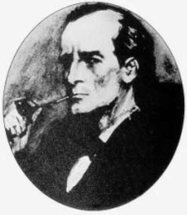 Do you know scientists and environmentalists often turn themselves into Sherlock Holmes?
Why? Well ,the reason , to borrow words from the great detective, is really very elementary. Scientosts and environmentalists often have to look for clues to help them understand what is going on in the climate-front. Here are some of the ways: Weather Stations Weather stations help us find out the temperature on the surface of the Earth. Weather stations use special thermometers that tell us the temperature. They can be set up almost anywhere on land. Weather stations also can tell us how fast the wind is moving and how much rain falls on the ground during a storm. In other words: A weather station is a facility with instruments and equipment to make observations of atmospheric conditions in order to provide information to make weather forecasts and to study the weather and climate. The measurements taken include temperature, barometric pressure, humidity, wind speed, wind direction, and precipitation amounts. Wind measurements are taken as free of other obstructions as possible, while temperature and humidity measurements are kept free from direct solar radiation, or insolation. Manual observations are taken at least once daily, while automated observations are taken at least once an hour. Weather Balloons 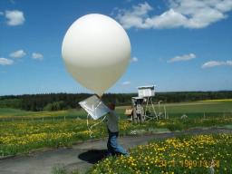 Weather balloons are released to float high up into the atmosphere. They carry special instruments that send all kinds of information about the weather back to people on the ground. Weather balloons are released to float high up into the atmosphere. They carry special instruments that send all kinds of information about the weather back to people on the ground.In other words: A weather or sounding balloon is a balloon (specifically a type of high altitude balloon) which carries instruments aloft to send back information on atmospheric pressure, temperature, and humidity by means of a small, expendable measuring device called a radiosonde. To obtain wind data, they can be tracked by radar, radio direction finding, or navigation systems (such as the satellite based Global Positioning System.). Weather Satellites The satellites that we have sent to space send back information to scientists on the ground. Some of the information they give us is about the weather and the Earth’s temperature. 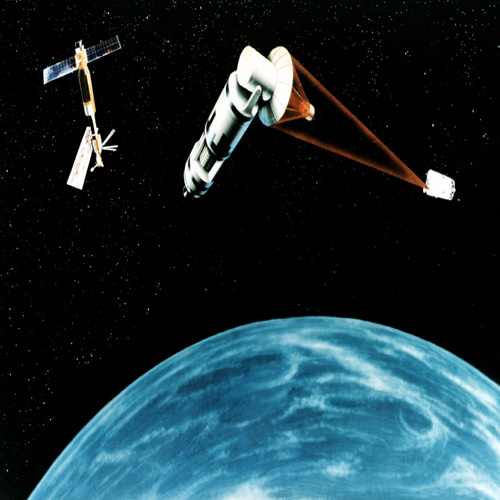 In other words:A weather satellite is a type of satellite that is primarily used to monitor the weather and climate of the Earth. Satellites can be either polar orbiting, seeing the same swath of the Earth every 12 hours, or geostationary, hovering over the same spot on Earth by orbiting over the equator while moving at the speed of the Earth's rotation.[1] These meteorological satellites, however, see more than clouds and cloud systems. City lights, fires, effects of pollution, auroras, sand and dust storms, snow cover, ice mapping, boundaries of ocean currents, energy flows, etc., are other types of environmental information collected using weather satellites. In other words:A weather satellite is a type of satellite that is primarily used to monitor the weather and climate of the Earth. Satellites can be either polar orbiting, seeing the same swath of the Earth every 12 hours, or geostationary, hovering over the same spot on Earth by orbiting over the equator while moving at the speed of the Earth's rotation.[1] These meteorological satellites, however, see more than clouds and cloud systems. City lights, fires, effects of pollution, auroras, sand and dust storms, snow cover, ice mapping, boundaries of ocean currents, energy flows, etc., are other types of environmental information collected using weather satellites.Ice Cores Environmentalists might study ice for clues about climate change.They have to study the ice from glaciers that have been around for a very long time for this purpose. There are inside pieces of ice air bubbles that were trapped in the ice hundreds or even thousands of years ago. These become visible when ice sheet is cut open. The evidence they uncover is creating a historical record of regional temperatures and greenhouse gas concentrations dating back 160,000 years. 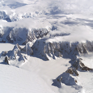 In other words:An ice core is a core sample from the accumulation of snow and ice over many years that have re-crystallized and have trapped air bubbles from previous time periods. The composition of these ice cores, especially the presence of hydrogen and oxygen isotopes, provides a picture of the climate at the time. In other words:An ice core is a core sample from the accumulation of snow and ice over many years that have re-crystallized and have trapped air bubbles from previous time periods. The composition of these ice cores, especially the presence of hydrogen and oxygen isotopes, provides a picture of the climate at the time.Ice cores contain an abundance of climate information. Inclusions in the snow of each year remain in the ice, such as wind-blown dust, ash, bubbles of atmospheric gas and radioactive substances. The variety of climatic proxies is greater than in any other natural recorder of climate, such as tree rings or sediment layers. These include (proxies for) temperature, ocean volume, precipitation, chemistry and gas composition of the lower atmosphere, volcanic eruptions, solar variability, sea-surface productivity, desert extent and forest fires. Typical ice cores are removed from an ice sheet, most commonly from the polar ice caps of Antarctica, Greenland or from high mountain glaciers elsewhere. As the ice forms from the incremental buildup of annual layers of snow, lower layers are older than upper, and an ice core contains ice formed over a range of years. The properties of the ice or inclusions within the ice can then be used to reconstruct a climatic record over the age range of the core. Sediment Analyses This one is easy to guess.Sediment is the earth and rock that has built up in layers over time. These layers reveal a lot about climate in the past. For example, ocean sediments provide a map of how ocean currents have flowed in the past. Fossilized pollen found in sediment layers tells us about where different plants have grown in the past.So on. In other words A varve is an annual layer of sediment or sedimentary rockThe word 'varve' is derived from the Swedish word varv whose meanings and connotations include 'revolution', 'in layers', and 'circle'. More recently introduced terms such as 'annually laminated' are synonymous with varve.In the geological record, varves are one of the most important and illuminating to studies of past climate change. Varves are amongst the smallest-scale events recognised in stratigraphy Tree Rings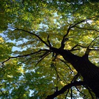 You must have studied this one in your Life Science class.You can tell a tree's age by counting its rings because it grows a new ring every year. But did you know that the sizes of the tree rings can tell us how much precipitation fell each year in the place where the tree lives? Precipitation could be either rain or snow or any other moisture that falls to the Earth. The different sizes of the rings tell us about changes in temperature and precipitation. You must have studied this one in your Life Science class.You can tell a tree's age by counting its rings because it grows a new ring every year. But did you know that the sizes of the tree rings can tell us how much precipitation fell each year in the place where the tree lives? Precipitation could be either rain or snow or any other moisture that falls to the Earth. The different sizes of the rings tell us about changes in temperature and precipitation.In other words: Dendrochronology or tree-ring dating is the method of scientific dating based on the analysis of tree-ring growth patterns. This technique was developed during the first half of the 20th century originally by the astronomer A. E. Douglass, the founder of the Laboratory of Tree-Ring Research at the University of Arizona. Douglass sought to better understand cycles of sunspot activity and reasoned (correctly) that changes in solar activity would affect climate patterns on earth which would subsequently be recorded by tree-ring growth patterns (i.e., sunspots → climate → tree rings). The technique of dendrochronology can date the tree rings in many types of wood to the exact calendar year each ring was formed. For more information log onto Wikipedia .Do let me know if I have missed out any tool for measuring climate change.Here is wishing you a very happy surfing and lots of joy of discovery! |
•
Home •
FEATURE •
INTERVIEW •
NEWS •
POLICY •
UPDATES •
REPORTS / INTERNATIONAL NEWS •